Chanarian Viewing Deck
True to her words, Mandy provided us a transportation to take us to the Chanarian viewing deck on that early morning of our third day in Batanes. On our first day of the trip a few of the workshop participants and I had expressed our interest in taking photos of the sea from the bottom of the cliff there and she had promised to provide transportation for us to do so on the third day. And thus after forcing myself to wake up very early (an hour before the sun was up, actually!) again I found myself in the rented jeepney heading towards the viewdeck.
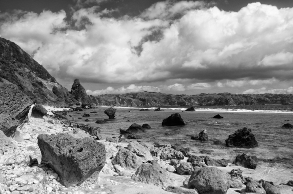
To cut the story real short, I didn’t like the results I got that morning. Getting good results in long exposure photography involving a brightening morning sky and still-dark landscape is tough without using a filter. The fact that I didn’t even own a tripod at the time really made the situation worse. I took a risk and put down my camera on the surface of a nearby rock, hoping that it was stable enough to keep my camera steady and wishing that it was safe enough from sea water. Sadly it didn’t help matter much when it came to the photo results. They were rather too soft, the colors were a bit wrong, the brightness a bit too low, and so on. To top it off, I was drowsy. I have to admit I really didn’t put a lot of effort into trying to get my composition right. I think that I might have put more effort into imagining that I was still in bed soundly and happily asleep.
But it wasn’t an entirely wasted effort. No, I’m talking about the effort in imagining that I was in bed. It is just that after 4 years and a substantial number of photoshop trials and errors, I managed to salvage one decent photo. The colors weren’t good enough so I did what (I think) a lot of photographers would do in this situation: make them black and white.
After having our fun we head back to the hotel to get breakfast and pick up the rest of the group. That day we would be visiting parts of Batan that we had not yet visited in our first day.
Map of Batan Island
Diura Fishing Village
Our first stop for the day was a fishing village called Diura. Being a fishing village, Diura was situated right next to a beach near Valugan Bay. When our jeepney arrived at the location we were immediately greeted with a strong aroma of salted fish. Not surprisingly, a lot of the result of the villagers’ daily catch were on display. Diura seemed to me like a very peaceful village whose populace were very friendly towards visitor. Most of them greeted us with big smiles on their faces. Those few who didn’t, gave us only a mild curious glance. As always, Mandy took us around the village for a tour. And, as always, I would wander outside of the group to take photos of the beautiful vistas that surrounded the village. As I wandered about the beach, I saw a large cone-shaped rock sitting nearby a cliff a bit to the north of the village. I would be seeing this particular landmark many times during our travel that day.
Diura was only our first stop of the day. We did not spend a lot of time in the village. After only roughly half an hour of exploration Mandy gathered us near the other end of the village opposite where our jeepney was parked and we continued our journey on foot towards a location where Mandy claimed a ‘fountain of youth’ can be found. Our jeepney would not be able to take us there as there were no road from Diura to the fountain. But the half-hour-or-so trek was worth the effort.
As we slowly ascend the hill running along the shore from Diura to Riacoyde (the place where the fountain was located) we could see a magnificent view of mount Iraya in the background and what looks like one of the many lighthouses that can be found in Batanes in the near distance (the lighthouse was named after the area, Mahatao, I found out later. Much later.). I also spotted another large cone-shaped rocks sitting on a nearby beach, similar to the one I spied earlier on nearby the village. They were like sentinels guarding the stretch of coast that lay between them. During the trek some of the group members and I were left behind because we really took our time to enjoy (and, of course, take photos of) the view.
The Fountain of Youth
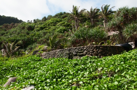
It might not show, but some members of the group are having a grand time preserving their youth inside the stone-walled pool
These days as I get older there were times when I wished I had immersed myself in the Fountain of Youth that day. Not that it truly grants you eternal youth, but as the vigor of youth started to slowly slip away from my aging body it seemed like it might have worth a try. Anyways, as I and a few other members who were lagging behind finally got to the fountain we found most of the group members who had arrived there earlier had dipped themselves inside the fountain and enjoying the refreshing pool water. The fountain itself looked like a circular pool lined with walls made out of volcano stones not unlike the large stones we saw when we visited Valugan Bay on our first day. Nothing special really, unless if it truly grants people what its name suggests.
Maybe I should really go back to Batanes.
I was an eager new photographer with a brand-spanking-shiny-new dSLR, and I was more interested in taking photos of the many beautiful landscapes that can be seen from the nearby beach at the Fountain (and trust me, there were many). So I headed straight to the beach to do just that. It was mostly a rocky beach just like Nakabuang, the beach that we visited in Sabtang on our second day of travel in the islands. The cone-like rock that we spied during our trek from Diura could be seen standing not far from where I was. Not long after that Mandy gathered us again at the beach so that we could all head towards our next destination, which was…
The Fishing Village of Diura
But we were just there! Oh but there was something different that time around: we would be going through a different route which involved a bit of climbing and/or traversing through (relatively shallow) sea water (at its deepest it was about knee-deep). During briefing a few weeks before our trip Mandy told us to bring footwear fit for walking through sea water. To me it translated to sandals. And trust me, that was a really wrong translation. The submerged terrain and the lapping waves made it hard for us to traverse our path through the sea water. Wearing sandals was obviously not helping. Many times I spent during our wet trek trying not to lose my sandals to the sea. I should have documented our interesting walk (it was really fun, despite all the trouble caused by my unwise decision of not wearing proper footwear), but being a new photographer who valued the camera more than the opportunity to take (potentially) great photos (I was afraid that I would somehow drop the camera into the water, damaging it), I did not.
There was one time where our path diverge. We could either choose to do a bit of rock climbing or continue on our path through the sea water. Some of us chose the rock-climbing path. I, and some other, chose to still traverse the watery path. This branching of our path was actually near the second cone-shaped rock I saw earlier that day on our way to the fountain. After our path converged and we exchanged notes, I found out that the rock-climbing path might have been a better choice. The water course was harder because the waves were stronger and we went through the part where the water was deepest. So why didn’t I go through the other path? I hate heights. So there you go. And I also had a bit of a bad rock climbing experience (I was ‘forced’ to go rock climbing, to be exact, but that would probably be a story for another time).
Back at the village of Diura, we spent some time again to explore the village and exchange a lot of smiles with the friendly villagers. We also used the time to rest a bit after our rather tiring-yet-entertaining wet trek back from the Fountain of Youth. This time Mandy gave us more time to explore the village. After roughly an hour she had us say goodbye to the village and its residents as we headed towards our next destination.
San Carlos Borromeo Church
That time it was another church visit. Our jeepney parked right outside the church’s entrance and we filed out and went into the church. It seems to have some sort of a historical significance, and I bet that at the time Mandy must have illustrated this to us. However I must admit that I didn’t pay attention to such things back then. It was all about taking photos for me. I didn’t find out at that time that this church was considered the first church ever built in Mahatao (a southern area in the island of Batan). I also didn’t know that there was a pair of lighthouses nearby which were considered the oldest (and smallest) in Batanes. I also didn’t know that it was one of the 26 churches recognized as cultural icons by the National Commission for Culture and the Arts and the National Museum of the Philippines. I was culturally unrefined. I probably still am, I suspect.
Anyhow, we didn’t spend too much time at the church (I was already wanting to go outdoor again). After spending some time exploring the interior of the church Mandy asked us to go back to our jeepney. Our next destination was a former village (or what remained of it) that was struck by a powerful tsunami in the past.
The Ruins of Songsong
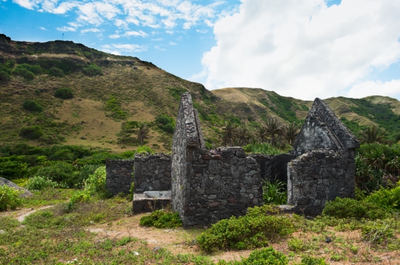
Our jeepney stopped near the base of a small hill that stood on one side of the road. A bit further on the left, on top of another hill stood some sort of a communication tower. On the other side of the road I could see a beach and a bit further ahead I saw a small collection of stone houses ruin. We got off and Mandy led us to the ruins on foot. As we explored the location, Mandy started talking about the current condition of the dilapidated stone houses that made up what was once a village. According to her the ruins were supposed to be a landmark. Looking at it, I agree that it would make a very interesting tourism spot. Sadly, it seemed that the local mayor didn’t think of it that way. Mandy told us, with no small hint of disgust in her voice, that the mayor was stealing stones from the ruins for building constructions. It was such a shame. I could understand why Mandy didn’t like that development. The ruins were indeed beautiful and it would be a fine tourist attraction. As I walked among the tall grasses that grew on what were probably streets that went between the ruined stone houses, I felt a small pang of sadness. Would the ruins of Songong still exist one day when I come back (if ever)? The hills that stood not far were quiet. They offered no answer. It’s been almost 4 years. I can only hope that it still exists today.
Imnajbu Road Cliffs
Our last destination of the day was Racuh A Payaman. For some reason the place was also called ‘Marlboro Country’. When Mandy mentioned the name, I thought that she was only joking. But she wasn’t. And later on I would find out why. Along the way to Mahatao our jeepney stopped where the road went between a tall cliff on the left and a huge rock on the right. It was obvious that once upon a time the cliff and the rock were one and the same. It seemed that people made a huge cut in the cliff and built a road that went through it.
There was a large patch of grass nearby where the rock stood. We all sat down there to enjoy one of the many magnificent views one can find in the islands of Batanes. To our right, the Imnajbu rock stood, and towards the sea we could see a wide surface of rock jutting out from the sea. We sat for a long time, taking lots and lots of photos and enjoying the winds brushing against our face and hair. We drank in the sight of waves breaking and crashing against the rocks just below where we sat.
After enjoying our relaxing moment it was time for us to move on to Racuh A Payaman.
Marlboro Country
We had lunch in a small hut nearby where the area called Marlboro Country was located. The caterer that Mandy hired to provide us with food was already there ready to serve us. We happily wolfed down our lunch. Not long after the brief-yet-satisfying lunch we found ourselves inside our rented jeepney again heading towards the so-called Marlboro Country. As we traversed the winding asphalt road I began to understand why Racuh A Payaman was called so. Like so many places in Batan and Sabtang (such as the areas around Tukon church, Naidi lighthouse, Chamantad-Tinyan) Racuh A Payaman is a vast and beautiful landscape of rolling hills. It reminded me of the landscape that you’d see in a Marlboro advertisement (aha!), but perhaps much greener.
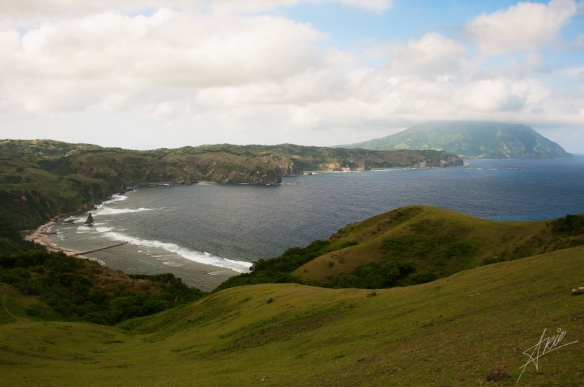
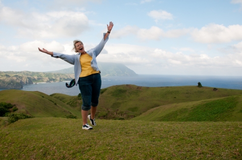
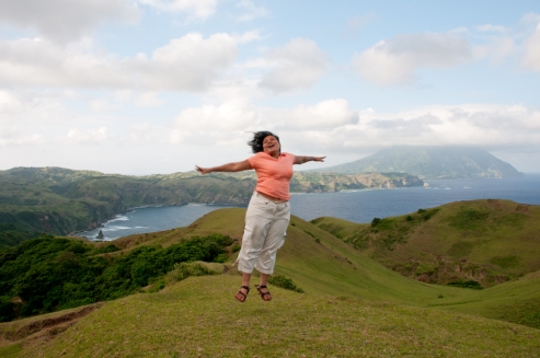
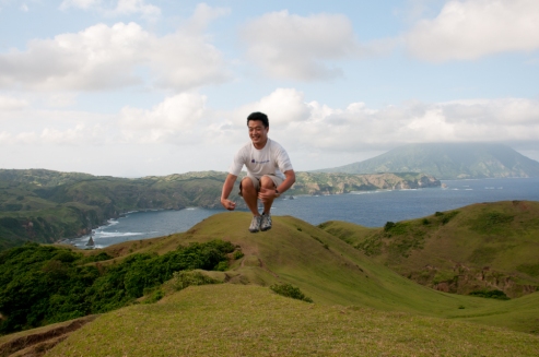
As our jeepney neared the location I also realized that we were going to a much higher ground. Finally it stopped at the end of an asphalt road that led us to the place and from there we went on foot. There were trail marks that we could follow as we started exploring the area. As we traversed the grassy slopes of the hills of Racuh A Payaman I can’t help but admire the beautiful landscape and the sweeping view of the island of Batan the higher ground provided us with. Off in the very distant north I could see Mount Iraya with its top covered with clouds. To the North I also spied the first cone-shaped rock that I saw earlier in Diura, which also meant that the fishing village was somewhere to the North from where we were. To the west I saw the lighthouse of Mahatao, which I also saw on our trek to the Fountain of Youth earlier that day. After a fair bit of walking, Mandy gathered us on a relatively-flat stretch of grass. As we sat and enjoy the view she said that we would be doing what many people called ‘jumpology’ photo session. Despite the rather fancy but weird sounding word, it was basically a name for an activity where you jump around making all sorts of silly poses and people taking photos of you in mid-air.
Hilarity ensued, of course.
One by one each of us took our turn to go to the middle of the flatland and did our own interpretation of ‘jumpology’. Those on photo duty started taking photos of the jumper with Mount Iraya and the northern part of the island as part of the background in the photos. As you can imagine it was overall a very fun session, perhaps the most fun that we had during our trip to Batanes. I mean, if you couldn’t get yourself happy from jumping about like little children then I don’t know what could. Just take a look at the photos.
Some of us explored the area till the end of many of the beaten paths that can be found in the area. Some went to other parts of the hills in Marlboro Country. The rest just sat down on the grass and enjoy the view. Satisfied with taking photos of the place, I sat down to rest. As I looked around, taking in the magnificent view of the island of Batan, I looked up and I saw a jet plane soaring high among the clouds. As I was seeing this, a sad realization dawned on me. That day was our last full day in Batanes. The next day I would be boarding a propeller plane taking me back to Manila. I knew then that I would sorely miss the beautiful islands of Batanes for the rest of my life, or at least till my next visit there. If ever.
Going Back
So it was with a heavy heart that I left Marlboro Country that evening after Mandy gathered us to go back to our lodging. That night I packed all my stuff in for our next day’s early morning flight back to the capital of the Philippines. After I had finished packing all of my things I decided to take a look at the collection of photos I took during our stay in Batanes. As I was looking through them, I realized how blessed I was to have the opportunity to see one of the many beautiful places in the world. What was more was that I had with me the memories of my stay there in the form of all the pictures I managed to take. That realization comforted me.
And sure enough, I still keep these memories until today.












You got some very nice images. It makes me want to travel again.
Thank you for reading and liking the post! I’m glad it inspires you to travel again.